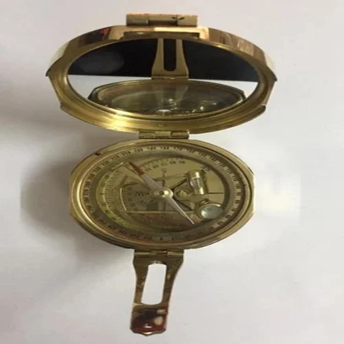
A brass Brunton compass is a precision tool for geologists, surveyors, and engineers to measure directional bearings (azimuths) and inclination (strike and dip) of geological features like rock layers, faults, and veins, using its integrated clinometer and mirror system for precise leveling and sighting, crucial for mapping and structural analysis. Its uses extend to general navigation and surveying, but it truly excels at detailed field geology by determining rock orientation with high accuracy, even measuring from a distance.
Description
The Brass Brunton Compass is a precision field instrument designed for accurate measurement of directional bearings and geological inclination. It combines a compass, clinometer, and mirror sighting system into a single robust tool. As a result, professionals can measure azimuths, strike, and dip of rock formations with high accuracy, even from a distance.
Geologists and surveyors across India regularly rely on brass Brunton compasses for field mapping and structural analysis. Similarly, professionals in countries such as the United States, Canada, and South Africa use this instrument for reliable orientation measurements in challenging outdoor environments.
Brass Brunton Compass for Bearing and Orientation Measurement
The Brass Brunton Compass allows users to determine magnetic bearings precisely using its balanced needle and graduated compass card. Surveyors and engineers use it to establish directions during land surveys and alignment work. Therefore, it plays an important role in navigation and basic surveying tasks.
Because the compass includes a mirror sighting mechanism, users can align targets accurately while reading measurements simultaneously. Moreover, this feature improves accuracy when measuring distant objects or inaccessible rock faces.
Brass Brunton Compass for Geological Fieldwork
The Brass Brunton Compass excels in geological applications such as measuring strike and dip of rock layers, faults, and veins. Geologists use the integrated clinometer to determine inclination angles during structural analysis. Consequently, they can map subsurface formations and understand land stability more effectively.
Field geology programs in countries such as Germany and Australia commonly include Brunton compasses in practical training. As a result, students gain hands-on experience with industry-standard tools used in professional geological surveys.
Integrated Clinometer and Mirror System
The built-in clinometer allows precise angle measurement without additional instruments. At the same time, the mirror system supports accurate leveling and sighting. Therefore, users can perform multiple measurements quickly while maintaining consistency in the field.
Suitable for Field Operations and Training
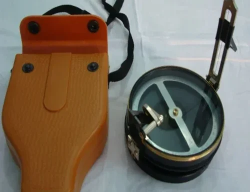
This brass Brunton compass is suitable for actual geological surveying, professional navigation, and educational training use. Professionals depend on it for real-world measurements, while instructors use it to teach geological orientation and mapping techniques.
Applications
- Measuring azimuths and directional bearings
- Geological strike and dip determination
- Structural geology and rock formation analysis
- Land surveying and navigation
- Field training in geology and earth sciences
other educational working models and laboratory kits to enhance hands-on learning in engineering and technical laboratories. In addition, institutions may also explore complementary learning solutions such as Jaadui Pitara educational learning kits to support interactive and concept-based education.
See also different:

Aluminum Leveling Staff
Prismatic Compass With Stand

Mirror Stereoscope With Binocular
Digital Compass Clinometer